LiDAR
Light Detection and Ranging (LiDAR) can determine how far objects are by shining a laser onto a targe.

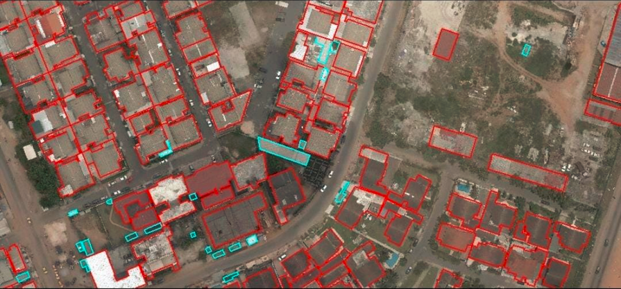
Earthscan Pro, provides quality UAV-Photogrammetry – Topographic and Planimetric Mapping, Digital Orthophotography, LiDAR Post Processing, Point Cloud to CAD-BIM Modelling data to International and Indian private and governmental agencies.
Guiding principles that drive our organization forward
To become the global leader in geospatial innovation, transforming how societies understand and interact with their environment through cutting-edge technology and sustainable solutions.
To deliver exceptional geospatial services through innovative mapping, precise data collection, and advanced analysis, empowering decision-makers with accurate information for a better tomorrow.
Find reasons to choose us as your freight partner

Light Detection and Ranging (LiDAR) can determine how far objects are by shining a laser onto a targe.
Lorem ipsum dolor sit amet, consectetur adipisicing elit. Vel alias recusandae dolorum debitis fugit quo numquam error.
Lorem ipsum dolor sit amet consectetur adipisicing elit. Ex esse hic cupiditate. Veniam dolorum quasi.
DTM includes mass points (X, Y, Z) but unlike DEM, they are not on a regularly spaced grid.
Lorem ipsum dolor sit amet consectetur adipisicing elit. Optio nulla consequatur debitis numquam dolorum, iusto minus necessitatibus.
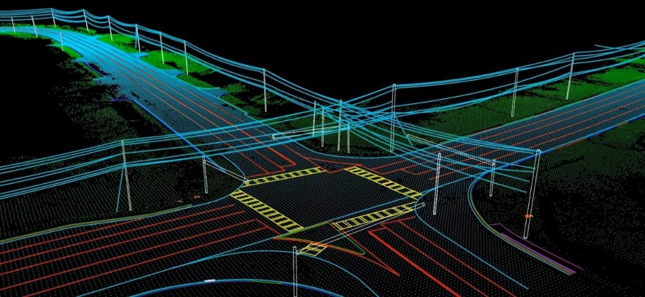
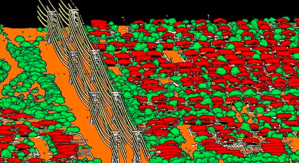
LiDAR can determine how far objects are away from each other by shining a laser onto a target and analyzing the light that bounces back
LiDAR can determine how far objects are away from each other by shining a laser onto a target and analyzing the light that bounces back
LiDAR can determine how far objects are away from each other by shining a laser onto a target and analyzing the light that bounces back
LiDAR can determine how far objects are away from each other by shining a laser onto a target and analyzing the light that bounces back